Only selected artifacts recovered during the December 2005 – April 2006 field season at Kuykendall Ruins were presented as photographs in the New Mexico Historical Review fall 2007 issue. In the interest of presenting a representative account, images of additional artifacts are furnished here. Portions of the narrative that accompany the photographs are derived from the never-to-be published personal chronicle compiled by Nugent Brasher during his search for the Coronado Trail beginning in September 2004 and extending to the present.
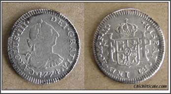
The 1774 Spanish coin represents the first significant artifact that we found during the inaugural season at Kuykendall. The coin was found on Saturday, January 28, 2006, the second day of the season. It was buried about 2 inches deep under the dirt road that passes through the Donka property, at a spot along the south side of Ruins Arroyo, the dry streambed that borders Kuykendall Ruins on the north. The location of this find is shown on Map 2 as published in our 2007 piece in the Review. The coin was located at the corner of a 50m x 50m grid quadrangle, and Dan Kaspar found it on his last metal detector sweep of the day. Had Dan not adhered to proper prospecting techniques, he would likely have missed the coin due to its proximity to a quad edge.
The following day we surveyed south of where the coin was found. At a spot immediately beside the dirt road, Nugent found the nail pictured in Figure 4 of our 2007 Review article. Like the coin, the nail was found at the very corner of a 50m x 50m quad. The location of the find is shown on Map 2 of the 2007 Review paper.
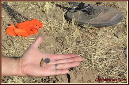
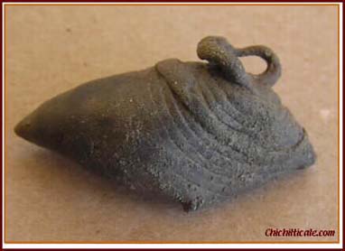
On Monday, January 30, 2006, we moved our search to the east to survey a color tone anomaly we observed on our DOQQ exploration map. Along the south boundary of a 50m x 30m quad, Dan Kaspar found a crossbow bolthead. The bolt was found directly under the nylon rope used to mark quad lines. Had the artifact been a meter more to the south, we would not have found it that day, and possibly not at all during the first season. This significant, diagnostic artifact was not immediately identified as a bolthead, although it was recognized as a corroded, ferrous, projectile-shaped object that could indeed be a bolthead.
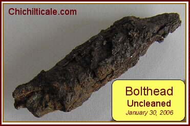
X-rays later proved the find to be the most important of the inaugural season. Figures 1, 2, and 3 of our 2007 Review piece illustrate and verify this consequential artifact. Map 2 shows where we found it.
Because of finding the Spanish coin in the dirt road and the nail directly beside the road, we decided to begin our search of Wednesday, February 1st, 2006, by having Dan Kaspar detector-sweep the road as he walked to the formally gridded search quad. This strategy resulted in the discovery of a Tarascan copper crotal buried two inches deep in the center of the road within a meter or so of where the nail had been found. Map 2 shows where the bell was unearthed.
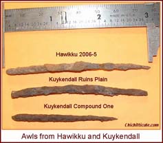
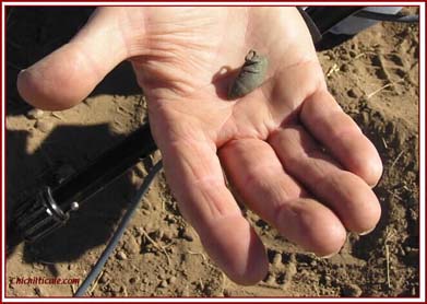
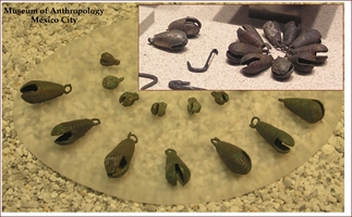
Our first formal survey of February 1st was located immediately south and adjacent to where the nail had been found, and included where the bell was found. Within a couple of meters of the bell, Dan Kaspar found an awl. This artifact was the third found within a circle of less than four meters in diameter. All three objects had been found independently because two were in different quads, and the third was found during the deliberate search of the road. This location is immediately beside the northeast corner of Compound One at a spot the Mills describe as having red walls. Map 2 shows this location.
A second awl was found during the inaugural season. The find was made on March 4, 2006 on Ruins Plain north of Ruins Arroyo. Nugent found the awl in soft dirt on the flank of a rodent mound. Map 2 displays where the second awl was discovered. The photograph presented above displays the two awls found at Kuykendall with an awl from Hawikku, which is near modern Zuni, New Mexico. Hawikku is the location of the first battle between the Indians of Cíbola and the Coronado Expedition. We are grateful to director Jonathan Damp of the Zuni Cultural Resource Enterprise for providing us access to the Hawikku artifact collection.
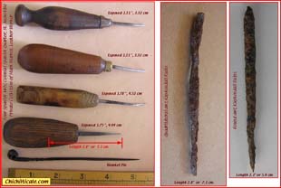
The awls found at Kuykendall Ruins compare nicely in size to the Spanish awls in the collection of Mark Warren, leatherworker at the Colonial Spanish Quarter in St. Augustine, Florida.
In the interest of furnishing some visual impressions of our exploration activities and of the Coronado Trail itself, we are providing the following images.
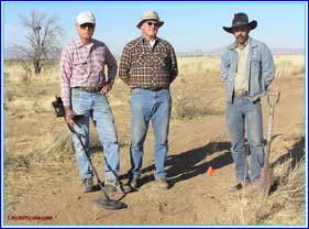
From the left: Dan Kaspar, Marc Kaspar, Gordon Fraser. Photograph taken when the Spanish coin was found. The dirt road can be seen, and the red flag marks the hole from which the coin was recovered. What we call Apache Peak, but what is officially named Helen’s Dome, is the dominant landmark on the south side of Apache Pass, and it can be seen on the horizon between Marc and Gordon.
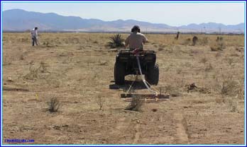
John Blennert is a renowned, professional meteorite prospector and a team member of the Coronado Trail Exploration Program. John designed a unique metal detecting rig that we field tested at Kuykendall. The rig is a Coil-Tec 40” coil fastened atop a static-free plastic sled and connected to a MineLab GP 3000 metal detector attached to an ATV. The driver-operator listens for targets through earphones. When a target is detected, the driver dismounts and marks the approximate target spot with a flag. A detectorist, the “digger,” using a handheld device, then locates the target and excavates it. The photograph displays the sled being pulled by the ATV and shows John Blennert locating a target with his handheld metal detector.
During the second season at Kuykendall, we used almost exclusively this rig, although we eliminated the ATV, preferring that a human “mule” pull the sled. The technique proved fast, thorough, and efficient – a team of “mule” plus “digger” could much more thoroughly cover four-times the amount of ground in an equal time than could a single detectorist using a handheld machine. The donation by John Blennert of this rig must be credited with the highly successful results obtained in the November 2006 – April 2007 second season at Kuykendall.
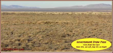
On June 16, 1540, Captain General Francisco Vázquez de Coronado started down the Río San Pedro. Juan Jaramillo recounted the trip some twenty years later. “We went two days down this arroyo, and leaving the arroyo we went to the right to the foot of the mountains in two days of journey, where we had knowledge that it was called Chichiltiecally.” The second day the expedition arrived at what is modern Lewis Spring, Arizona and set camp. The morning of the third day the expedition left the Río San Pedro and made its famous right-hand turn, heading to Chichilticale. This route took the riders and walkers through what is modern Government Draw Pass, the easiest, shortest way to reach Apache Pass from the upper end of the Río San Pedro. The night of June 18th the expedition camped near Soldiers Hole. The next day they reached the fabled Red House. This route is shown on Map 1 of our 2007 Review paper.
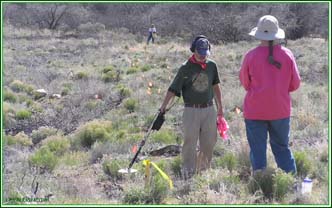
The expedition rested three nights, two days and an evening at Chichilticale. On the morning of June 22nd, 1540, Coronado and his band of travelers trekked to Apache Pass. We attempted to find artifacts of the expedition at Ft. Bowie National Historic Site in Apache Pass. National Park archaeologist Charlie Haecker is shown metal detecting in Parke Triangle at Fort Bowie on April 10, 2005. He is searching along a grid line created by a nylon cord held by Shirley Flint and Karen Brasher. Yellow flags mark the targets detected by Charlie. The search for Coronado artifacts at the site produced no 16th century finds. The quantity of 1870 – 1890 military materials greatly impacted the survey by producing hundreds of targets to excavate. On the positive side, Park Ranger Larry Ludwig was delighted that our team detected a Spanish pistol.
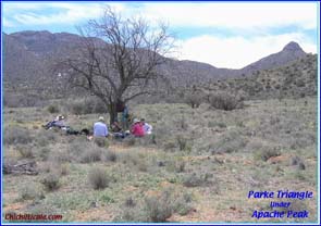
The Fort Bowie National Historic Site includes the Butterfield stage station and the military cemetery. These are located in a wide meadow that we call Parke Triangle. On the east side of Parke Triangle is Apache Spring. Spring and surface water historically drain into Siphon Canyon. We believe that the expedition camped at Parke Triangle, Apache Spring and Siphon Canyon on June 22, 1540. The location of this camp is shown on Map 1 of our 2007 Review paper.
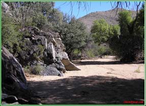
The following morning, the eve of the San Juan Feast, expedition members passed through Siphon Canyon to enter the San Simon Valley en route northward to their June 23rd camp.
The Coronado Expedition set camp the night of June 23, 1540 in an open valley surrounded on three sides by rugged mountains. We searched a very small portion of the western valley and found a lead ball that might be an artifact of the expedition. We continue to explore the site, which is located on a private ranch.
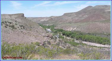
On the morning of June 24th, 1540, St. John’s Day, the expedition continued northward, arriving that afternoon at a river Coronado named the Río San Juan in honor of the day of that Saint. On the modern calendar, the date was July 4th, and the campsite was in a hidden valley on the present-day Río Gila. After a thorough reconnoitering, we concluded that the famous Río San Juan campsite has been destroyed by natural events.
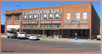
Almost a year after passing through Arizona and New Mexico, the Coronado Expedition found itself on the Great Plains in modern Texas. Their camp in Blanco Canyon, Texas was struck by a strong storm in the spring of 1541, which caused the loss of hundreds of items. The location of these lost objects was discovered in the middle 1990s and was named the Jimmy Owens site after the local metal detectorist who discovered it. The Floyd County Historical Museum in Floydada, Texas holds a representative portion of the significant artifacts found at the Jimmy Owens site. Everyone interested in the Coronado saga should consider visiting the museum because the collection of expedition artifacts seen there represent the largest number on public display. We extend our gratitude to museum founding member Nancy Marble for granting us access to the entire Jimmy Owens collection available at the museum.
